Haling Grove (Croydon)
Brief Description
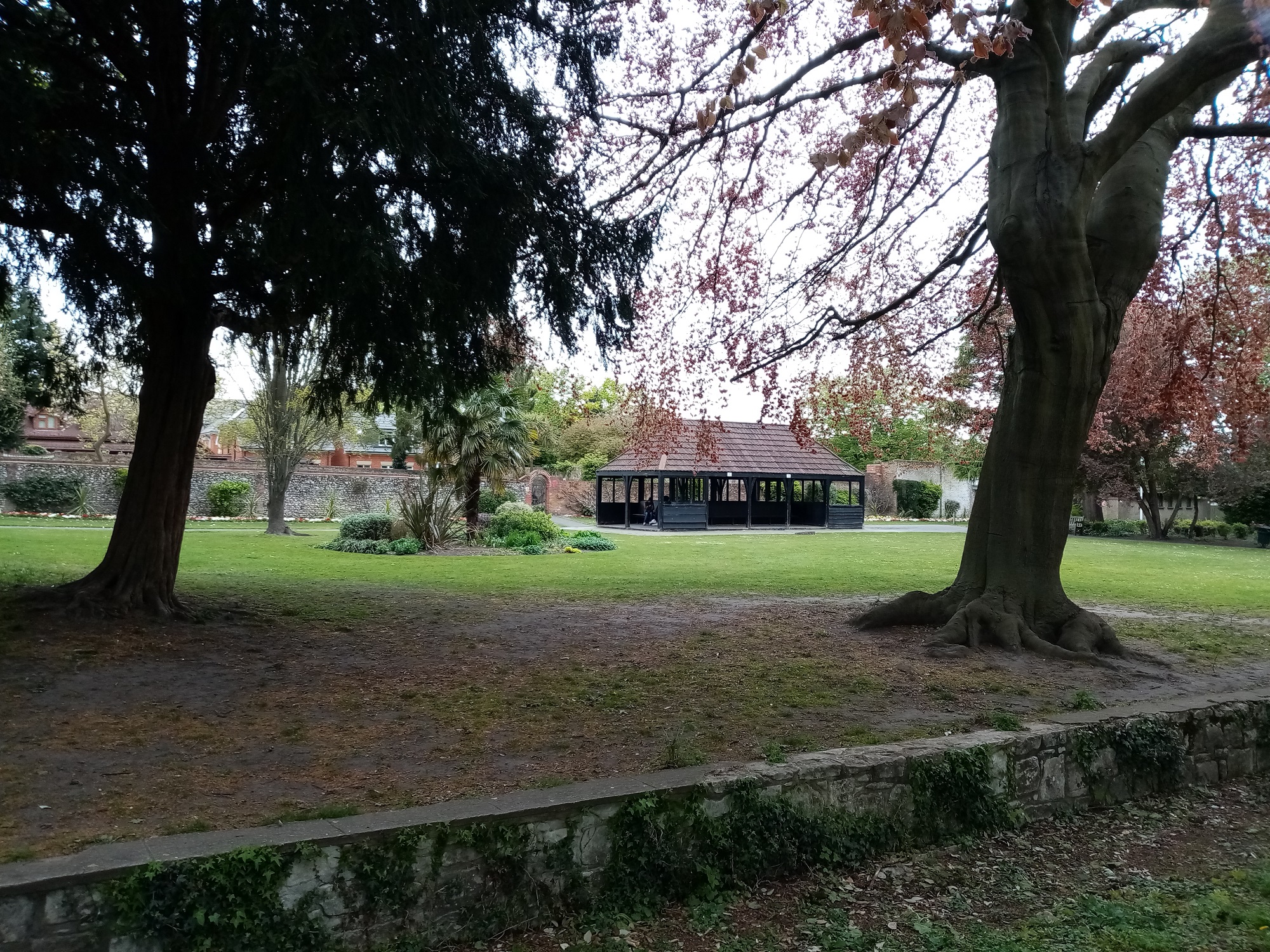
The park was formerly the grounds of Haling Grove, an early Victorian house built on land originally part of the much larger Haling Park estate. Haling Grove had a succession of owners, the last being Sydney Shorter who bred horses here. After his death, his widow bequeathed the property to the Playing Fields Association in 1933, who transferred it to Croydon Corporation. After the house was demolished in 1936, the lawn was extended over its site and a small shelter erected. Remnants of the formal gardens, fine trees and shrubberies, and other features remain, such as a ha-ha, coach house and two walled gardens, one of which has an Arts and Crafts garden.
Practical Information
- Previous / Other name:
- Haling Park Estate
- Site location:
- St Augustine's Avenue, South Croydon
- Postcode:
- CR2 6DQ
- What 3 Words:
- finely.gasp.scam
- Type of site:
- Public Park
- Borough:
- Croydon
- Open to public?
- Yes
- Opening times:
- 8am Mon-Fri/9am weekends - dusk
- Special conditions:
- Facilities:
- Sports facilities, changing rooms, toilets, children’s playground
- Events:
- Public transport:
- Rail: Sanderstead, Purley Oaks


- Research updated:
- 01/12/2008
- Last minor changes:
- 19/07/2023
Please check with the site owner or manager for latest news. www.croydon.gov.uk
Full Site Description
The land was formerly the grounds of Haling Grove, once part of the much larger Haling Park country estate, most of which was sold for building in 1850 and now largely occupied by Whitgift School (q.v.). The house at Haling Grove was probably very early Victorian, and was occupied by a succession of owners, the last being Mr Sydney Shorter, a London merchant, who was frequently seen exercising his horses at the Grove, or riding a high trap through the town. Mr Shorter was also a breeder of horses and apart from the breeding he carried out at Haling Grove he also owned a Stud Farm at Cookham. He employed a coachman, two grooms and a stable boy at Haling Grove. Mr Shorter died in 1929 and his wife, who was not interested in horses, did not continue to keep them. She bequeathed Haling Grove to the Playing Fields Association in 1933, who transferred it to Croydon Corporation to maintain.
The house was demolished in 1936 and the lawn was extended over its site. Colourful displays of bedding and herbaceous plants are laid out on the lawn and below this there is a meadow with many fine mature trees. The house and garden was separated by a bank of trees from the old kitchen garden, which has been developed as a rose walk. The original bequest requires the meadow to the south to be used as a playing field for organized games although this was temporarily interrupted when the field was used for allotments during and just after the war when food was scarce.
The small park to the east of the house is shown on the first edition Ordnance Survey plan of 1868. The structure of the formal garden to the south, with a straight walk aligned onto a mature Sycamore, is shown on the same plan. Other mature trees found in the grounds include an Oak and Sycamore clump, vestiges of two Beech clumps to the east and single Oaks, and Cedar of Lebanon. There is a yew shrubbery on the south side of the house platform, a ha-ha and two walled gardens, one with a rectangular Arts and Crafts pond and terrace. A wooden shelter, formerly thatched, stands on the site of the house. The ha-ha still exists as does the original coach house, the former visible behind the children's playground.
Sources consulted:
MA Winterman, Croydon's parks: an illustrated history (LB Croydon, 1988) p42; Cherry, B and Pevsner, N, The Buildings of England London 2: South (1983) p222; LB Croydon, 'Local List of Historic Parks & Gardens', December 2008.
Further Information (Planning and Conservation)
- Grid ref:
- TQ321633 (532133,163249)
- Size in hectares:
- 4.05
- Site ownership:
- LB Croydon
- Site management:
- Parks and Open Spaces
- Date(s):
- C19th; 1930s
- Designer(s):
- Listed structures:
- None
- On National Heritage List for England (NHLE), Parks & Gardens:
No- Registered common or village green on Commons Registration Act 1965:
No- Protected under London Squares Preservation Act 1931:
No
Local Authority Data
The information below is taken from the relevant Local Authority's planning legislation, which was correct at the time of research but may have been amended in the interim. Please check with the Local Authority for latest planning information.
- On Local List:
- Yes
- In Conservation Area:
- No
- Tree Preservation Order:
- No
- Nature Conservation Area:
- Yes - Local Importance
- Green Belt:
- No
- Metropolitan Open Land:
- Yes
- Special Policy Area:
- Yes - Archaeological Priority Zone (part)
- Other LA designation:
- Local Open Land. Partly AP2
Photos

Haling Grove - ha-ha and shelter - Photo: Colin Wing
Date taken: 07/05/21 14:39Click a photo to enlarge.
Please note the Inventory and its content are provided for your general information only and are subject to change. It is your responsibility to check the accuracy.