Fairfield Recreation Ground (Kingston)
Brief Description
Fairfield Recreation Ground was provided as a public recreation ground in 1865 but had long existed as a market and meeting place. It continued to be used for livestock trading into the C20th, for example for Kingston Horse Fair from 1866 and a cattle market from 1925. It was also the venue for town celebrations and pageants. Today it is used for sports and informal recreation, a rectangular, largely grassed site that still has its Victorian railings. It is divided north / south by a path flanked by an avenue of mature lime trees, with trees around its perimeter including lime and London plane. Silver maple and cherry are among other trees planted in the park.
Practical Information
- Previous / Other name:
- The Fairfield
- Site location:
- Fairfield South/Fairfield Road, Kingston
- Postcode:
- KT1 2PY
- What 3 Words:
- club.stones.tiger
- Type of site:
- Public Park
- Borough:
- Kingston
- Open to public?
- Yes
- Opening times:
- unrestricted
- Special conditions:
- Facilities:
- Children's playground, football and cricket pitches, trim trail, toilets
- Events:
- Various, including May Merry, normally over May Day Bank Holiday weekend.
- Public transport:
- Rail: Kingston. Bus: K1, K4


- Research updated:
- 01/04/2012
- Last minor changes:
- 19/07/2023
Please check with the site owner or manager for latest news. www.kingston.gov.uk/browse/environment/parks/recreation_sites
Full Site Description
The Fairfield has long been in existence and is shown clearly on the C17th map of Kingston with fields to the east, and houses along the west side towards the river. From early days it was an important market and meeting place. Having become somewhat disreputable by the 1850s, and dangerous after dark, it was enclosed with railings in 1865 in order to preserve it as open space and to provide a public recreation ground, a move largely at the instigation of the Mayor, John Williams. Kingston was an important market town since the granting of its charter by Charles I in 1628 whereby markets were not permitted within a 7 mile radius and after its enclosure Fairfield subsequently replaced Market Place for livestock trading, becoming the site of Kingston Horse Fair from 1866 and the cattle market from 1925. The latter continued until the late 1930s when local farming was dwindling. Town celebrations were regularly held here such as the Kingston Tudor Pageant in 1917 raising money for the war, and in 1935 the Jubilee Fair to celebrate King George's Silver Jubilee. It was used during both world wars, for allotments in WWI when food was short and people were encouraged to grow their own, and in WWII when trenches seating 2,700 people were built at Fairfield in the Munich Crisis of 1938.
Sources consulted:
A McCormack, Kingston Upon Thames, London, 1989; Shaan Butters, 'The Book of Kingston', Baron, 1995; Tim Everson 'Kingston, Surbiton and Malden', Phillimore, 2000 ed; Sue Swales, Ian Yarham, Bob Britton, 'Nature Conservation in Kingston upon Thames', Ecology Handbook 18 (London Ecology Unit) 1992; Ben Weinreb & Christopher Hibbert, 'The London Encyclopaedia' (Macmillan, revised ed. 1993).
Further Information (Planning and Conservation)
- Grid ref:
- TQ184690 (518480,169080)
- Size in hectares:
- 2.451
- Site ownership:
- RB Kingston
- Site management:
- Grounds maintenance contractor: Quadron Services Ltd
- Date(s):
- 1865
- Designer(s):
- Listed structures:
- LBII: Kingston Library and Museum, Stone from King John's Palace in Library courtyard; gate piers to Library
- On National Heritage List for England (NHLE), Parks & Gardens:
No- Registered common or village green on Commons Registration Act 1965:
No- Protected under London Squares Preservation Act 1931:
No
Local Authority Data
The information below is taken from the relevant Local Authority's planning legislation, which was correct at the time of research but may have been amended in the interim. Please check with the Local Authority for latest planning information.
- On Local List:
- No
- In Conservation Area:
- Yes
- Conservation Area name:
- Fairfield/Knight's Park
- Tree Preservation Order:
- No
- Nature Conservation Area:
- No
- Green Belt:
- No
- Metropolitan Open Land:
- No
- Special Policy Area:
- Yes - Area of Archaeological Significance
- Other LA designation:
- Local Open Space (Public Open Space). Green Corridor along Fairfield South
Photos
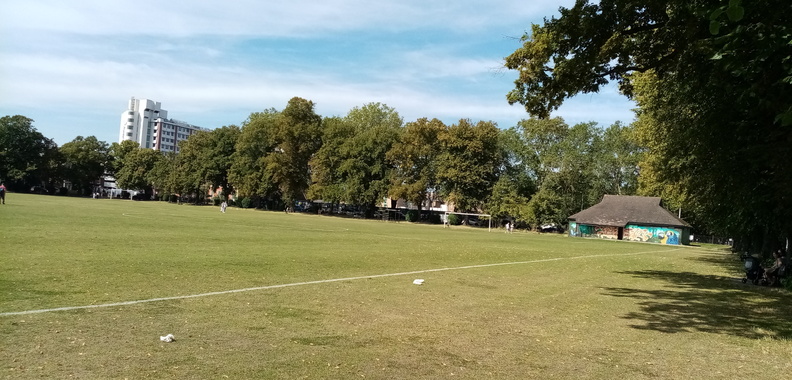
Fairfield Recreation Ground - Photo: Colin Wing
Date taken: 03/09/23 14:16Click a photo to enlarge.
Please note the Inventory and its content are provided for your general information only and are subject to change. It is your responsibility to check the accuracy.
