Ladywell Fields (Lewisham)
Brief Description
Ladywell Fields is a public park situated on three historic fields that in medieval times were part of the manor of Lewisham. The area, through which the Ravensbourne river runs, is named after a medicinal well recorded from the at least the C15th. The arrival of the railways in the 1850s gradually brought development to the area and in 1889 the land between the river and the railway was purchased and opened as Ladywell Recreation Ground. Because the area was liable to flooding the river channel was straightened and enlarged, weirs were added, and the meadows were drained and landscaped. Between 2007 and 2011 the park has undergone significant enhancement schemes, which have focused on re-naturalising the river corridor, improving the landscape for wildlife as well as people.
Practical Information
- Previous / Other name:
- Ladywell Recreation Ground
- Site location:
- Ladywell Road/Ravensbourne Park/Dressington Avenue/Malyons Road/Iona Close/Bourneville Road, Ladywell
- Postcode:
- SE13 7UW
- What 3 Words:
- slap.grades.family
- Type of site:
- Public Park
- Borough:
- Lewisham
- Open to public?
- Yes
- Opening times:
- unrestricted
- Special conditions:
- Facilities:
- Play areas, skate park, tennis courts, adventure playground, water pumps; ball courts, bowling green, ball courts, football pitch, café; Waterlink Way cycle route
- Events:
- Public transport:
- Rail: Catford/Ladywell. Bus: 47, 54, 75, 136, 185, 199, 208, 284, P4, 122.


- Research updated:
- 13/06/2024
- Last minor changes:
- 26/02/2025
Please check with the site owner or manager for latest news. www.lewisham.gov.uk/inmyarea/openspaces/parks
Full Site Description
Ladywell Fields is a public park made up of three historic fields through which the Ravensbourne River flows. A mile long, the park runs between Ladywell and Catford. In 1086 the Domesday Book refers to 'the 30 acres of meadow in the Manor of Lewisham', part of which is now Ladywell Fields. They are named after the medicinal well first recorded in 1472, whose site is now beneath the access road to Ladywell Station, called 'Our Lady's Well' after the parish church of St Mary's. A second mineral well was to the west of the original site of the spring. The well's properties were apparently particularly good for treatment of eye complaints. The well house of the spa still existed in 1842, coping stones of which were taken to form the back of the fountain in the grounds of the old public baths, re-instated in front of Ladywell Baths. Ladywell began as a 'squatter village' from the late 1780s, where parishioners leased strips of manorial wasteland and were permitted to build cottages on application to the manor court. By the Nineteenth Century these fields were water meadows attached to the nearby parish church and the land was largely in agricultural use. The Ravensbourne River rises at Kestons Ponds and reaches the Thames at Deptford Creek, joined just south of Catford by the River Pool. This stretch of river was the site of numerous snuff and flour mills, and a moated farm house, Priory Farm, which was demolished in 1877 when the moat was filled in. Further development of Ladywell took place after the arrival of the railways in 1857 when the Mid Kent and North Kent Railway Line was constructed, its route running through the three Ladywell Fields. Ladywell station opened in 1857 and terraces were built nearby. From the 1880s onwards there was greater expansion in the area, with the old wasteland cottages cleared for new houses and shops. The area between the Ravensbourne and the railway was purchased by the London County Council (LCC) and Lewisham District Board of Works in 1889 for £21,880; further land along the Ravensbourne was purchased in 1891 and 1894 and the site was laid out as a public amenity for the growing population of the area, with rustic footbridges and riverside planting. The area's farmland gradually disappeared, with Slagrave Farm purchased in 1894 by the Bermondsey Poor Law Union for a workhouse for the elderly poor. The last farm in the area, Bridge House Farm, was demolished in c.1899. In 1892 another railway line had been built by the London, Dover and Chatham Railway Company, its route running through the most southerly field.
The park originally opened as Ladywell Recreation Ground; the OS maps of 1894/6 show a drinking fountain near the north entrance and on one map a bandstand is marked although this does not appear in subsequent maps; a layout of paths are shown in the middle field, but no other sports facilities are marked until post-war maps of 1949, which show the running track and pavilion, and tennis courts. The park now has numerous play areas and sports facilities and is part of the Waterlink Way cycle route, and Ladywell Bowling Green is sutuated in the park. There are a good number of mature trees, including a fine field maple in the south, a hybrid black poplar and a mature elm on the river bank, which has a Great Tree of London plaque.
Ladywell Fields User Group was established in the 1990s to protect and conserve the park and have undertaken numerous projects over the years. In 2007/8 there were major improvements to the northern field to divert the river into the main area of the field as part of the Quercus project with European Union funding. In 2010/11 further enhancements were carried out to the middle and southern fields to open the river up. In 2011 the Ladywell Fields User Group planted a community orchard in the south field, where there are currently 32 trees that include apple, pear, plum and cherry varieties. They participate in twice-yearly river clean-ups with Thames 21 as well as running planting and other landscape management sessions. A small nature reserve known as Iona Close Orchard is located in the middle field, formerly an old orchard in the gardens of a pair of villas that had fallen into disuse by the mid-Twentieth Century, and was rediscovered in 2012/13. Designated a Site of Importance for Nature Conservation, the nature reserve is managed by Lewisham Council's Ecology Manager and volunteers from Ladywell Fields User Group.
A Tiny Forest was planted on 22 November 2022 as part of a project to speed up tree growth and bring nature to urban communities. Local councillors and representatives from Bloomberg, the Tiny Forest's sponsor, were joined by pupils from Prendergast Ladywell School to help plant the forest, which also marked the start of a new partnership between Earthwatch Europe and STEM Learning, with Prendergast Ladywell School and the Tiny Forest at its heart. A Tiny Forest is a dense, fast-growing native woodland, about the size of a tennis court. These forests are not only great homes for butterflies, birds, bees and other wildlife but also a place for people to connect with, and learn about, nature. Each forest is a unique public asset – planted and cared for by the local community. Aiming to mimic natural forests but in a small space, they include a mix of native trees which, over time, will create a wildlife-rich woodland. Earthwatch Europe is pioneering Tiny Forest in the UK and is part of the global Tiny Forest Network, working in partnership with IVN Natuureducatie.
Sources consulted:
John Archer, Ian Yarham, 'Nature Conservation in Lewisham', Ecology Handbook 30, London Ecology Unit, 2000 and Lewisham Walk 2 leaflet; LB Lewisham, "Parks historical trail"; Ben Weinreb & Christopher Hibbert, 'The London Encyclopaedia' (Macmillan, revised ed. 1993); Darrell Spurgeon, 'Discover Sydenham and Catford', (Greenwich Guide-books, 1999);BDP, 'Ladywell Fields, Lewisham - End of Scheme Report' c.2011; https://ideal-homes.gre.ac.uk/lewisham/assets/histories/ladywell.html; https://ladywellfields.blogspot.com/; Candy Blackham, 'Green Lewisham', (Clink Street Publishing, 2022); https://tinyforest.earthwatch.org.uk/about
Further Information (Planning and Conservation)
- Grid ref:
- TQ371739 (537150,173950)
- Size in hectares:
- 22
- Site ownership:
- LB Lewisham
- Site management:
- Greenscene Department, Glendale Grounds Management; Friends of Ladywell Fields
- Date(s):
- 1889-94
- Designer(s):
- Listed structures:
- None
- On National Heritage List for England (NHLE), Parks & Gardens:
No- Registered common or village green on Commons Registration Act 1965:
No- Protected under London Squares Preservation Act 1931:
No
Local Authority Data
The information below is taken from the relevant Local Authority's planning legislation, which was correct at the time of research but may have been amended in the interim. Please check with the Local Authority for latest planning information.
- On Local List:
- No
- In Conservation Area:
- No
- Tree Preservation Order:
- No
- Nature Conservation Area:
- Yes - Local Importance
- Green Belt:
- No
- Metropolitan Open Land:
- Yes
- Special Policy Area:
- adjacent to APA
- Other LA designation:
- Green Corridor
Photos

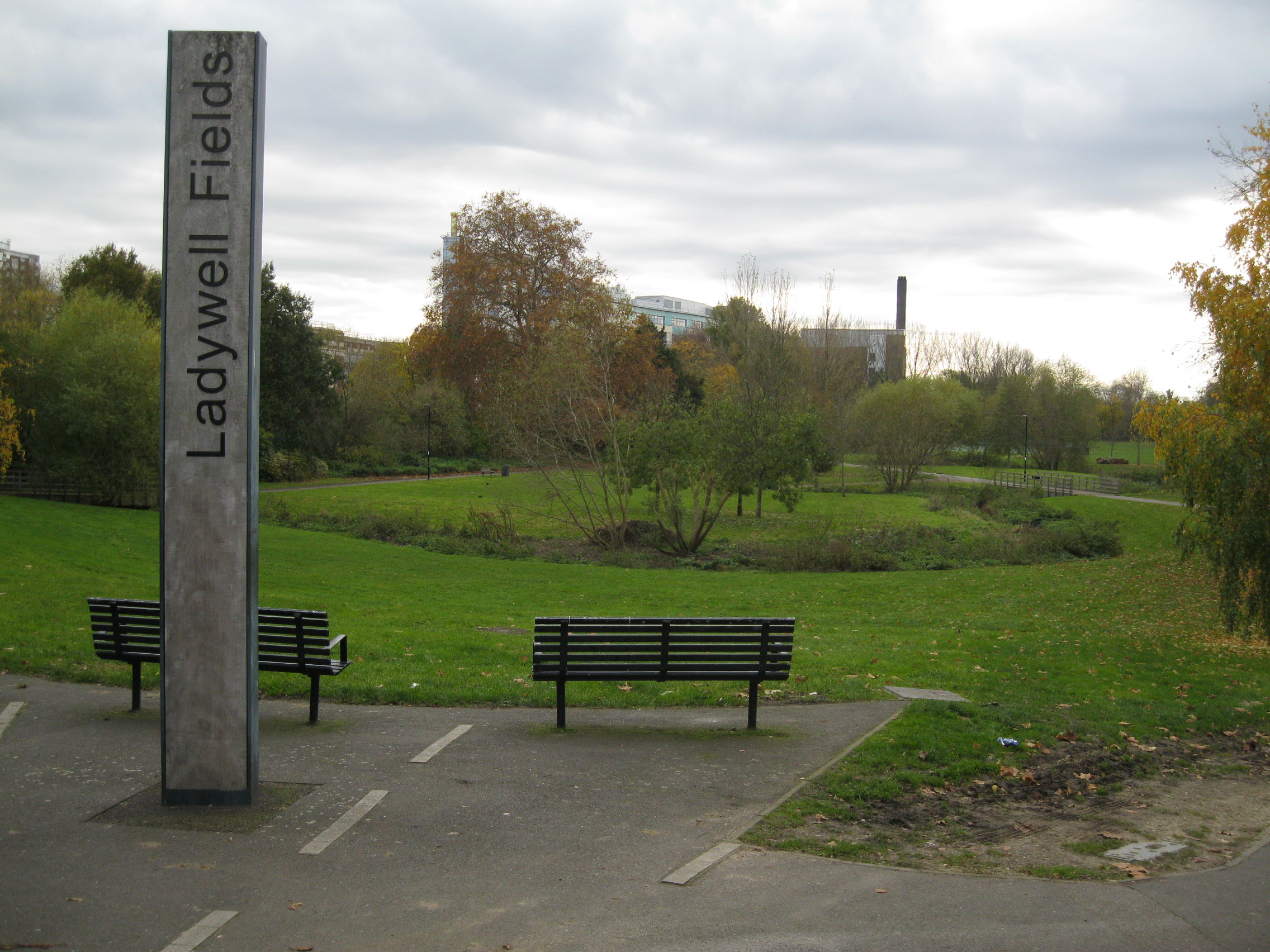
Ladywell Fields - Photo: Colin Wing
Date taken: 19/11/19 15:04Click a photo to enlarge.
Please note the Inventory and its content are provided for your general information only and are subject to change. It is your responsibility to check the accuracy.