Hackbridge Green (Sutton)
Brief Description
Hackbridge Green is an old village green, today a triangular open space with fine mature trees and C18th cottages forming the backdrop. The 1st edition OS map of 1867 shows the site as open space.
Practical Information
- Site location:
- Hackbridge Green
- Postcode:
- SM6 7AU
- What 3 Words:
- humid.patio.spray
- Type of site:
- Public Open Land
- Borough:
- Sutton
- Open to public?
- Yes
- Opening times:
- unrestricted
- Special conditions:
- Facilities:
- Events:
- Public transport:
- Rail: Hackbridge. Bus: 127, 151.


- Research updated:
- 01/11/2004
- Last minor changes:
- 14/07/2022
Please check with the site owner or manager for latest news. www.sutton.gov.uk
Full Site Description
Pending further research
Sources consulted:
Further Information (Planning and Conservation)
- Grid ref:
- TQ283659 (528210,165933)
- Size in hectares:
- 0.15
- Site ownership:
- LB Sutton
- Site management:
- Parks
- Date(s):
- C18th
- Designer(s):
- Listed structures:
- LBII: Nos. 9-15 (odd) Hackbridge Green; Old Red Lion Inn
- On National Heritage List for England (NHLE), Parks & Gardens:
No- Registered common or village green on Commons Registration Act 1965:
Yes: Green (TVG66)- Protected under London Squares Preservation Act 1931:
No
Local Authority Data
The information below is taken from the relevant Local Authority's planning legislation, which was correct at the time of research but may have been amended in the interim. Please check with the Local Authority for latest planning information.
- On Local List:
- No
- In Conservation Area:
- No
- Tree Preservation Order:
- No
- Nature Conservation Area:
- No
- Green Belt:
- No
- Metropolitan Open Land:
- No
- Special Policy Area:
- No
- Other LA designation:
- None
Photos
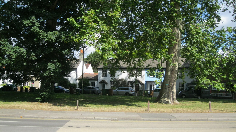
Hackbridge Green - Photo: Colin Wing
Date taken: 07/07/20 09:59Click a photo to enlarge.
Please note the Inventory and its content are provided for your general information only and are subject to change. It is your responsibility to check the accuracy.
