Mercers Burial Ground (Tower Hamlets)
Brief Description
Former burial ground opened by the Non-conformist Stepney Meeting in 1779, which also built almshouses, a Meeting House and school here. The burial ground closed in 1853. The almshouses, school and Meeting House were bombed in WWII, and the small oblong burial ground was made into a public garden in 1976. It retains some chest tombs, head stones and ledger slabs, but formerly possessed fourteen large crypts.
Practical Information
- Previous / Other name:
- Stepney Meeting House Burial Ground
- Site location:
- White Horse Road/Salmon Lane/Matlock Street
- Postcode:
- E14
- What 3 Words:
- envy.tiles.hosts
- Type of site:
- Public Gardens
- Borough:
- Tower Hamlets
- Open to public?
- Yes
- Opening times:
- unrestricted
- Special conditions:
- Facilities:
- Events:
- Public transport:
- Tube: Stepney Green (District, Hammersmith & City)


- Research updated:
- 01/05/2012
- Last minor changes:
- 19/07/2023
Please check with the site owner or manager for latest news. www.towerhamlets.gov.uk
Full Site Description
The disused Burial Ground on White Horse Road between Matlock Street and Salmon Lane was opened by the Non-conformists Stepney Meeting in 1779. They also rebuilt almshouses for 8 old women on a site to the left of the gravel path in the burial ground today. In 1785 the Stepney Meeting built a small charity school between the almshouses and Salmon Lane, which was used until 1821. The almshouses, school and first Meeting House in Salmon Lane were bombed in WWII. The small oblong burial ground had closed to burials in 1853 and was made into a public park in 1976. It retains some chest tombs, head stones and ledger slabs, but formerly possessed fourteen large crypts. There are remains of the brick parapet on the west side, and there is a wall on the north side, with 3 boundary stones around the periphery. Opposite the burial ground is a row of mid C19th cottages. Elder, sycamore, lime and fig are found throughout the garden, which is mainly grass with a path running through it.
Sources consulted:
Tom Ridge, Central Stepney History Walk, (Central Stepney Regeneration Board) 1998
Further Information (Planning and Conservation)
- Grid ref:
- TQ360813 (536108,181382)
- Size in hectares:
- 0.1005
- Site ownership:
- LB Tower Hamlets
- Site management:
- Leisure Services, Parks and Open Spaces
- Date(s):
- mid C18th; 1976
- Designer(s):
- Listed structures:
- None
- On National Heritage List for England (NHLE), Parks & Gardens:
No- Registered common or village green on Commons Registration Act 1965:
No- Protected under London Squares Preservation Act 1931:
No
Local Authority Data
The information below is taken from the relevant Local Authority's planning legislation, which was correct at the time of research but may have been amended in the interim. Please check with the Local Authority for latest planning information.
- On Local List:
- No
- In Conservation Area:
- Yes
- Conservation Area name:
- York Square
- Tree Preservation Order:
- No
- Nature Conservation Area:
- No
- Green Belt:
- No
- Metropolitan Open Land:
- No
- Special Policy Area:
- No
- Other LA designation:
- None
Photos
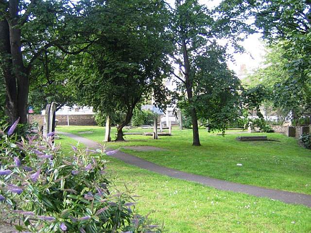
Mercers Burial Ground, June 2009. Photo: S Williams

2009 
2009 
2000 
1896 Click a photo to enlarge.
Please note the Inventory and its content are provided for your general information only and are subject to change. It is your responsibility to check the accuracy.