Albert Embankment and Albert Embankment Gardens (Lambeth)
Brief Description
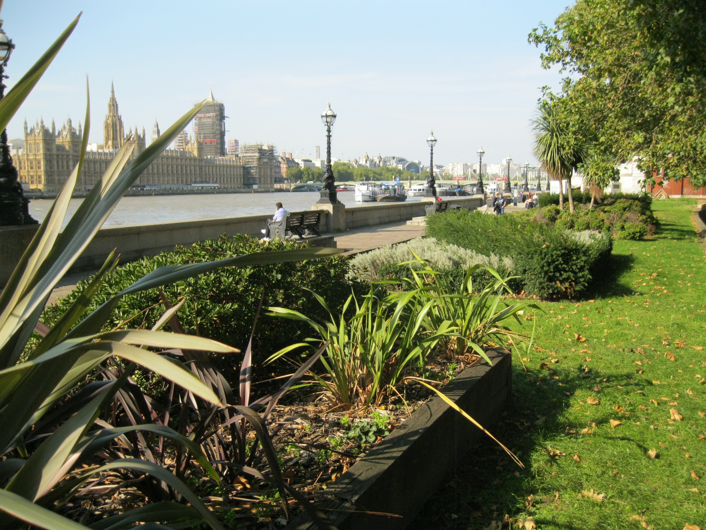
The Albert Embankment forms part of the riverside opposite the Victoria Embankment, constructed in the 1860s to alleviate London's sewage problems. The Albert Embankment promenade opened in 1868, a paved walkway with stone balustrade, benches giving views over the river and lamp standards that were replicas of those on the opposite Embankment. There are three areas of public gardens south of Lambeth Bridge, to the north of which is a raised area of planting with grass and trees, including a Holm oak planted for the Millennium. A memorial for members of the Special Operations Executive was unveiled on 4 October 2009. The National Covid Memorial Wall is located at the north end of Albert Embankment near St Thomas's Hospital, a public mural of painted hearts instigated by Covid-19 Bereaved Families for Justice in March 2021 and now over 500m long.
Practical Information
- Site location:
- Albert Embankment/Lambeth Palace Road
- Postcode:
- SE1 7TP
- What 3 Words:
- lost.inch.values
- Type of site:
- Public Park
- Borough:
- Lambeth
- Open to public?
- Yes
- Opening times:
- unrestricted
- Special conditions:
- Facilities:
- Events:
- Public transport:
- Rail/Tube: Vauxhall (Victoria); Waterloo (Jubilee, Northern, Bakerloo). Bus: 1, 4, 59, 68, 76, 159, 381, 705


- Research updated:
- 12/05/2023
- Last minor changes:
- 13/11/2023
Please check with the site owner or manager for latest news. https://www.lambeth.gov.uk/parks/albert-embankment-gardens
Full Site Description
There has been settlement along this stretch of the Thames from early times, with Vauxhall Plate Glass Works established here by 1670 and from the C18th wharves and warehouses were built for the various industrial activities that were developing, including soap works and potteries such as Doulton's, which produced fine majolica and stoneware. At that time the riverside had a sloping sandy beach and boat building and related industries became established. However, by the mid C19th the river was increasingly polluted with industrial substances and sewage outfall and in order to remove this problem the Victoria Embankment (q.v.) was constructed, creating a new sewage drainage system to carry waste away from the metropolis. The Embankment was planned by Sir Joseph Bazalgette, Chief Engineer for the Metropolitan Board of Works, which had been set up in 1855 and authorised this, its first major project, in 1863.
The Albert Embankment was constructed between 1866-69 as part of the project in order to prevent flooding in times of high tide while the new drainage scheme was laid out on the opposite bank. Named after Prince Albert, who had died in 1861, the reclamation of land from the river to create the embankment cost £1m and resulted in the loss of much of the old riverside village of Lambeth and its industries. Nos. 36 and 37 Albert Embankment, Vintage House, is the last warehouse to remain, recalling the earlier history of the area. The cast iron lamp standards and ornate benches along the Albert Embankment riverside promenade replicate those on the Victoria Embankment. The lamp standards have pairs of dolphins or sturgeon around a fluted column topped with a lamp holder and crown, the bases showing the MBW's coat of arms and monogram and the date '1870'. The name of the foundry Masfield & Co and the architect George Vulliamy are also recorded, and many of the pedestals have a bronze lion's head with a ring in its mouth. The C19th cast iron benches, which have ornamental panels and arms shaped like swans, have now been raised on modern plinths to afford better riverside views.
Trees within the boundary of St Thomas's Hospital (q.v.), which was built in 1871 on the land reclaimed from the river, line the walk to the north. South of Lambeth Bridge, the Albert Embankment's granite retaining wall continues for 0.5km towards Vauxhall Bridge. North of Lambeth Bridge opposite Lambeth Palace (q.v.) is an area of landscaping set within long raised beds planted with grass, roses and trees, including an evergreen holm oak planted for the Millennium by the Mayor of Lambeth in December 1999. A monument commemorating members of the Special Operations Executive (SOE) was erected on the grass ridge between Queens Walk and Lambeth Palace Road north of Lambeth Bridge. The memorial was unveiled on 4 October 2009 at a ceremony attended by the Duke of Wellington KG, and was commissioned by The Public Memorials Appeal. The memorial comprises a granite plinth set on a paved area reached by a ramped path and is surmounted by a bronze portrait bust by sculptor Karen Newman of Violette Szabo (1921-45). A former Lambeth resident, Violette Szabo joined the SOE and became a French resistance heroine. She was eventually caught by German troops in 1945, and was the first woman to be awarded the George Cross posthumously on 7 December 1946. Plaques attached to the granite plinth and base record information about the SOE and the acts of sabotage performed in enemy-occupied countries in WWII: that on the north face records the Heroes of Telemark, and that on the south face commemorates The Maquis French Resistance Fighters and Violette Szobo. A plaque on the base records the commissioning of the monument by The Public Memorials Appeal, its Patron the Duke of Wellington and Trustees Ivan Saxton (founder), Lady Barbirolli OBE, Michael Kennedy CBE and Ian Davidson, Hon. Secretary. North of this area of landscaping a drinking fountain is set into the wall of a small red brick shelter. There is a further area of rose bushes by Lambeth Bridge.
In March 2021 the creation of a National Covid Memorial was instigated as a public commemoration of victims of the Covid-19 pandemic in the UK. Organised by Covid-19 Bereaved Families for Justice and Led by Donkeys the memorial takes the form of a public mural of red and pink hearts painted by volunteers along the Albert Embankment wall opposite the Houses of Parliament and Palace of Westminster. Each heart is painted for each of the casualties of Covid-19 who died in the UK with Covid on their death certificate. 150,000 hearts were hand-painted over 10 days from 29 March 2021, which bereaved families then filled with messages and names. Since then more hearts have continued to be painted and new dedications added; the mural now stretches over 500 metres along the wall. The memorial was not officially authorised at the outset but has received widespread support and while the original plan included provision to clean the wall after a period of time, there is a campaign for it to remain as a permanent memorial. It is maintained by bereaved volunteers who have formed the Friends of the Wall, and who are exploring how it can be preserved with the local council and St Thomas's Hospital. An older plaque on the wall is dedicated to the 1994-96 human BSE outbreak.
The OS 25 ins map of 1871 shows planted areas either side of Lambeth Bridge, and between Lambeth Bridge and Vauxhall Bridge are a series of linear public gardens, known as Albert Embankment Gardens. These comprise one garden between the river and Tintagel House, the largest garden area by Peninsular Heights, which has a number of mature trees, and a smaller garden by Queensborough House (Nos. 12-18 Albert Embankment). The OS Map 1:1250 of 1949 shows the larger area planted by that date, but the area to the south was not planted until later in the C20th.
To the north and continuous with the promenade is The Queen's Walk (q.v.), which covers the section of riverside from Westminster Bridge to Blackfriars Bridge adjacent to County Hall, Jubilee Gardens (q.v.) and the Royal Festival Hall, which was opened in 1952.
Sources consulted:
Marie Draper 'Lambeth's Open Spaces, An historical account', LB Lambeth 1979; Ian Yarham, Michael Waite, Andrew Simpson, Niall Machin, 'Nature Conservation in Lambeth', Ecology Handbook 26 (London Ecology Unit), 1994; LB Lambeth, Albert Embankment Conservation Area Designation Report; South Bank Conservation Area Statement 2007; War Memorials Register: https://www.iwm.org.uk/memorials/item/memorial/57804 ; https://nationalcovidmemorialwall.org/
Further Information (Planning and Conservation)
- Grid ref:
- TQ305792 (530550,179250)
- Size in hectares:
- 0.42
- Site ownership:
- LB Lambeth
- Site management:
- Environment Directorate, Parks and Greenspaces Unit
- Date(s):
- 1868
- Designer(s):
- Listed structures:
- LBI: Lambeth Palace. LBII: Albert Embankment Riverside Wall and C19th Lampstandards, St Thomas' Hospital boundary wall
- On National Heritage List for England (NHLE), Parks & Gardens:
No- Registered common or village green on Commons Registration Act 1965:
No- Protected under London Squares Preservation Act 1931:
No
Local Authority Data
The information below is taken from the relevant Local Authority's planning legislation, which was correct at the time of research but may have been amended in the interim. Please check with the Local Authority for latest planning information.
- On Local List:
- No
- In Conservation Area:
- Yes
- Conservation Area name:
- within 3 CAS: South Bank, Lambeth Palace and Albert Embankment
- Tree Preservation Order:
- No
- Nature Conservation Area:
- Yes - Metropolitan Importance (Thames)
- Green Belt:
- No
- Metropolitan Open Land:
- Yes
- Special Policy Area:
- Yes - Thames Policy Area
- Other LA designation:
- Open Space
Photos

Albert Embankment Gardens - Photo: Colin Wing
Date taken: 16/09/20 15:37Click a photo to enlarge.
Please note the Inventory and its content are provided for your general information only and are subject to change. It is your responsibility to check the accuracy.