St Matthew's Church Gardens (Lambeth)
Brief Description
St Matthew's Church was one of the four 'Waterloo' churches built in Lambeth following the Napoleonic wars. The churchyard was officially closed for burials in 1853. The southern part of the former burial ground was conveyed to Lambeth Borough Council for a public garden in 1953, the northern part in 1958. Road realignments in 1960 altered the site, extending it to the north-east and reducing it to the north-west. The garden was designated a Peace Garden in the 1980s. At the northern tip of the gardens is a substantial monument to Richard Budd, erected 1825.
Practical Information
- Previous / Other name:
- St Matthew's Public Open Space
- Site location:
- St Matthew's Road/Brixton Hill/Effra Road
- Postcode:
- SW2 1RP
- What 3 Words:
- songs.ruby.forget
- Type of site:
- Public Gardens
- Borough:
- Lambeth
- Open to public?
- Yes
- Opening times:
- unrestricted
- Special conditions:
- Facilities:
- Children's play area (dog free)
- Events:
- Public transport:
- Rail/Tube: Brixton (Victoria)


- Research updated:
- 01/04/2022
- Last minor changes:
- 18/09/2023
Please check with the site owner or manager for latest news. https://www.lambeth.gov.uk/parks/st-matthews-church-gardens; www.stmatthewsbrixton.org
Full Site Description
The Waterloo churches were built in celebration of the victory over Napoleon following the Battle of Waterloo. It was also a time of social upheaval and political unrest, with a growing population and unemployment, increased by demobilised solders. The Church Commissioners desired to build new churches to counteract 'godless mob violence' and the spread of non-conformism, and in 1818 an Act of Parliament approved a sum of money for the new churches, with £64,000 allocated to Lambeth in 1822. The other three Waterloo churches are St Mark Kennington, St Luke West Norwood and St John Waterloo (q.q.v.).
St Matthew's Church was built in 1822-24 designed by C F Porden, and was consecrated in 1824. The church grounds were originally part of Rush Common (q.v.), a large area of open land that belonged to the historical Manor of Lambeth. When this was eventually enclosed and divided up at the start of C19th, a triangle of land was used to build St Matthew's and its churchyard. At the north tip of the church grounds is the monument to Richard Budd (d.1824), which was erected by his son Henry Budd in 1825, the work of R. Day. Described as the 'finest in the metropolis', the large monument on a stepped plinth is, like the church, in Greek revival style. It was excepted from the later conveyance of the churchyard to Lambeth Borough Council . The southern part of the former burial ground was conveyed to the Borough Council for a public garden in 1953, the northern part in 1958. Road realignments in 1960 altered the garden, extending it to the north-east and reducing it to the north-west. The garden was designated a Peace Garden in c.1985, when it was laid out with flower beds and a water feature, with new trees planted, and plaque set into the paving.
Sources consulted:
Marie Draper 'Lambeth's Open Spaces, An historical account', LB Lambeth 1979; Ian Yarham, Michael Waite, Andrew Simpson, Niall Machin, 'Nature Conservation in Lambeth', Ecology Handbook 26 (London Ecology Unit), 1994
Further Information (Planning and Conservation)
- Grid ref:
- TQ309750 (530984,175095)
- Size in hectares:
- 0.53
- Site ownership:
- LB Lambeth
- Site management:
- Environment Directorate, Parks and Greenspaces Unit (Team Lambeth)
- Date(s):
- 1820s; 1953
- Designer(s):
- Listed structures:
- LBII*: St Matthew's Church; Budd Memorial. LBII: Churchyard Gate Piers to west and east of Church
- On National Heritage List for England (NHLE), Parks & Gardens:
No- Registered common or village green on Commons Registration Act 1965:
No- Protected under London Squares Preservation Act 1931:
No
Local Authority Data
The information below is taken from the relevant Local Authority's planning legislation, which was correct at the time of research but may have been amended in the interim. Please check with the Local Authority for latest planning information.
- On Local List:
- No
- In Conservation Area:
- Yes
- Conservation Area name:
- Brixton
- Tree Preservation Order:
- No
- Nature Conservation Area:
- No
- Green Belt:
- No
- Metropolitan Open Land:
- No
- Special Policy Area:
- Yes - Archaeological Priority Area
- Other LA designation:
- Rush Common Land. Open Space
Photos
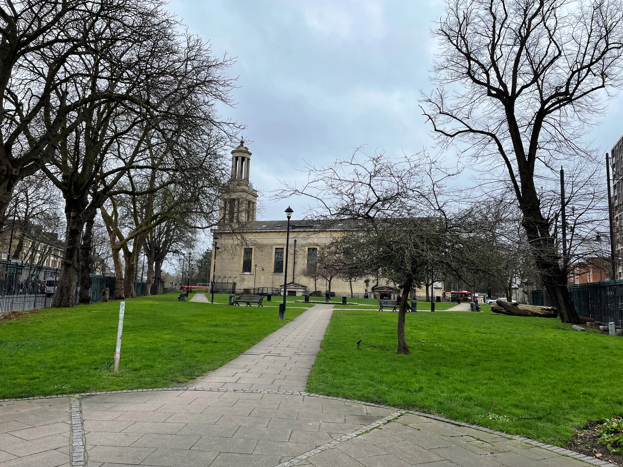
St Matthew's Church Gardens, February 2022. Photograph Sally Williams

2022 
2012 
2012 
2012 
2009 Click a photo to enlarge.
Please note the Inventory and its content are provided for your general information only and are subject to change. It is your responsibility to check the accuracy.