Watermeads Housing Estate (Merton)
Brief Description
Watermeads Estate was built in 1974-7 by R Hodge and A Bews of Merton Borough Architects Department, on the site of Mitcham Grove, a large house that is shown on the OS Map of 1935 with the land to the west marked as sports ground and to the north tennis courts. The estate was one of a series of low-rise housing schemes that incorporated landscaping. A fine cedar tree remains from the former grounds of Mitcham Grove, and a new lake was created alongside the river to the south.
Practical Information
- Previous / Other name:
- Grove House
- Site location:
- off Rawnsley Avenue/Bishopsford Road
- Postcode:
- CR4
- What 3 Words:
- hops.dame.dined
- Type of site:
- Housing/Estate Landscaping
- Borough:
- Merton
- Open to public?
- No
- Opening times:
- private, visible from Ravensbury Park
- Special conditions:
- Facilities:
- Events:
- Public transport:
- Rail: Mitcham. Tube: Morden (Northern) then bus. Tramlink: Mitcham. Bus: 118, 280.


- Research updated:
- 01/02/2005
- Last minor changes:
- 14/07/2022
Please check with the site owner or manager for latest news.
Full Site Description
Residents' reaction to the earlier Pollards Hill estate (q.v.) of 1968 led to Watermeads' 'looser and less dogmatic arrangement' and 'greater sensitivity in landscaping of the hard and grass areas'. The estate comprises 186 houses or flats in 3-storey ribbon of terraces overlooking the landscaped grounds that lead to the Wandle River, and the public park, Ravensbury Park (q.v.), adjoins to the west. The estate won a Design Award and has been described by Pevsner as 'One of the most attractive council developments of the 1970s in London'.
Sources consulted:
Bridget Cherry & Nikolaus Pevsner, The Buildings of England: London 2: South (Penguin) 1999 p435, 445/6; 'Mitcham, Ravensbury', Merton Town Trails 6 (Merton Town Trails Association, 1979)
Further Information (Planning and Conservation)
- Grid ref:
- TQ270679 (527050,167950)
- Size in hectares:
- Site ownership:
- private
- Site management:
- Date(s):
- 1974-7
- Designer(s):
- Merton Borough Architects Department
- Listed structures:
- None
- On National Heritage List for England (NHLE), Parks & Gardens:
No- Registered common or village green on Commons Registration Act 1965:
No- Protected under London Squares Preservation Act 1931:
No
Local Authority Data
The information below is taken from the relevant Local Authority's planning legislation, which was correct at the time of research but may have been amended in the interim. Please check with the Local Authority for latest planning information.
- On Local List:
- No
- In Conservation Area:
- Yes
- Conservation Area name:
- Wandle Valley
- Tree Preservation Order:
- Not known
- Nature Conservation Area:
- No
- Green Belt:
- No
- Metropolitan Open Land:
- No
- Special Policy Area:
- Yes - Archaeological Priority Zone
- Other LA designation:
- None
Photos
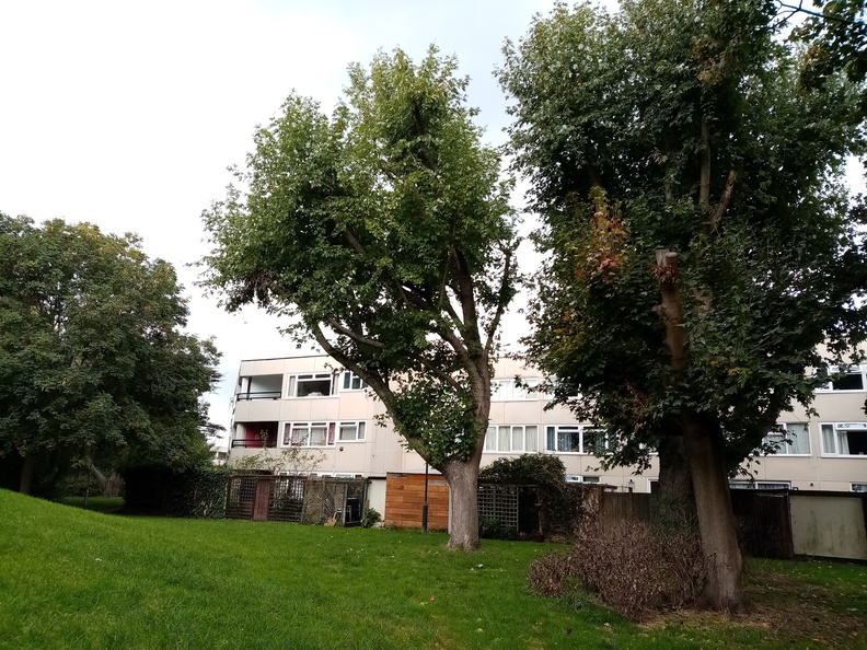
Watermeads Housing Estate - Photo: Colin Wing
Date taken: 16/10/21 14:26Click a photo to enlarge.
Please note the Inventory and its content are provided for your general information only and are subject to change. It is your responsibility to check the accuracy.
