Pondfield Park (Barking & Dagenham)
Brief Description
The park consists of two recreation areas divided by Reede Road, which were at first separately named, but since the 1980s together form Pondfield Park. The land, unsuitable for building, was presented to Barking by the London County Council in the late 1920s. The northern Park had perimeter planting, paths, avenues of trees and is largely playing fields, while the Recreation Ground in the south was laid out with children's playground, paddling pool, drinking fountains and planting.
Practical Information
- Previous / Other name:
- Pondfield Recreation Ground
- Site location:
- Pondfield Road/Reade Road, Dagenham, Essex
- Postcode:
- RM10
- What 3 Words:
- drips.flesh.belong
- Type of site:
- Public Park
- Borough:
- Barking & Dagenham
- Open to public?
- Yes
- Opening times:
- unrestricted
- Special conditions:
- Facilities:
- Children's playground, I basketball court
- Events:
- Public transport:
- Tube: Dagenham East (District) then bus. Bus: 364.


- Research updated:
- 01/04/2002
- Last minor changes:
- 19/07/2023
Please check with the site owner or manager for latest news. www.barking-dagenham.gov.uk
Full Site Description
In the late 1920s, the LCC presented 9 acres of land unsuitable for building development to Barking Council - two areas bisected by Reede Road. The northern part (Pondfield Park) was laid out with paths, avenue of trees and perimeter planting, while the south (Pondfield Recreation Ground) contained a children’s playground, paddling pool, drinking fountains, and planting. In the early 1950s the Council wanted to improve the layout of the Recreation Ground but the Ministry of Health refused to sanction a loan for this although the Council proposed to ‘pay out of ready money’. Since the 1980s the whole area is now Pondfield Park, and contains playing fields, rose gardens set in a depressed shallow turfed bowl and some notable trees such as willows and horse chestnuts. 2008: new children's play area was opened.
Sources consulted:
Dagenham Digest, October 1949, March 1955; Dagenham Digest, October 1949 and January 1951
Further Information (Planning and Conservation)
- Grid ref:
- TQ496852 (549853,185139)
- Size in hectares:
- 5.70
- Site ownership:
- LB Barking & Dagenham
- Site management:
- Parks & Countryside Ranger Service
- Date(s):
- 1930
- Designer(s):
- Listed structures:
- None
- On National Heritage List for England (NHLE), Parks & Gardens:
No- Registered common or village green on Commons Registration Act 1965:
No- Protected under London Squares Preservation Act 1931:
No
Local Authority Data
The information below is taken from the relevant Local Authority's planning legislation, which was correct at the time of research but may have been amended in the interim. Please check with the Local Authority for latest planning information.
- On Local List:
- No
- In Conservation Area:
- No
- Tree Preservation Order:
- No
- Nature Conservation Area:
- No
- Green Belt:
- No
- Metropolitan Open Land:
- No
- Special Policy Area:
- No
- Other LA designation:
- None
Photos
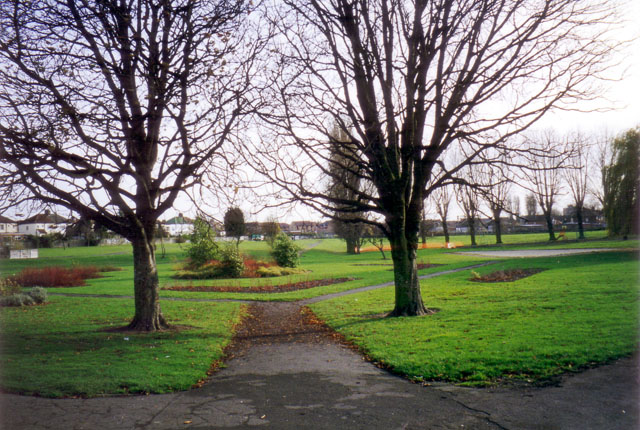
Pondfield Park, South, November 1999. Photo: S Williams

1999 
1999 Click a photo to enlarge.
Please note the Inventory and its content are provided for your general information only and are subject to change. It is your responsibility to check the accuracy.