The Queen's Walk (Lambeth)
Brief Description
The Queen's Walk is part of the Thames Riverside Walk, a promenade that runs from Blackfriars Bridge to south of Westminster Bridge, from where it extends southwards as Albert Embankment. An area of landscaping was initially laid out when County Hall was built and finished in 1917, but in 1949 the riverside walk was extended as a promenade for the 1951 Festival of Britain and retained as public open space when the Festival ended, opening in 1952.
Practical Information
- Previous / Other name:
- Riverside Walk
- Site location:
- Westminster Bridge to Gabriels Wharf, South Bank
- Postcode:
- SE1 7PB
- What 3 Words:
- saving.thing.bounty
- Type of site:
- Public Open Land
- Borough:
- Lambeth
- Open to public?
- Yes
- Opening times:
- unrestricted
- Special conditions:
- Facilities:
- Events:
- Public transport:
- Rail/Tube: Waterloo (Northern, Waterloo and City, Jubilee, Bakerloo). Bus: 1, 4, 68, 76, 159


- Research updated:
- 13/11/2023
- Last minor changes:
- 13/11/2023
Please check with the site owner or manager for latest news. www.lambeth.gov.uk
Full Site Description
The Festival of Britain was conceived as a celebration and incentive to restoration following the end of WWII and it also marked the centenary of the Great Exhibition of 1851 held in Hyde Park (q.v.). The riverside area between Waterloo Bridge and County Hall became the site of the Festival, an area that had suffered much bomb damage. An embankment and walk were created to provide a high quality vehicle-free pedestrian streetscape, and architectural structures by Britain's leading architects and designers were built for entertainments and exhibitions, with the Royal Festival Hall its centrepiece and only permanent building. Along the Queen's Walk are remains of Festival of Britain railings with timber hand rails. In 1953 the LCC approved the master plan for developing the Festival site as a cultural and commercial centre, which became known as the South Bank.
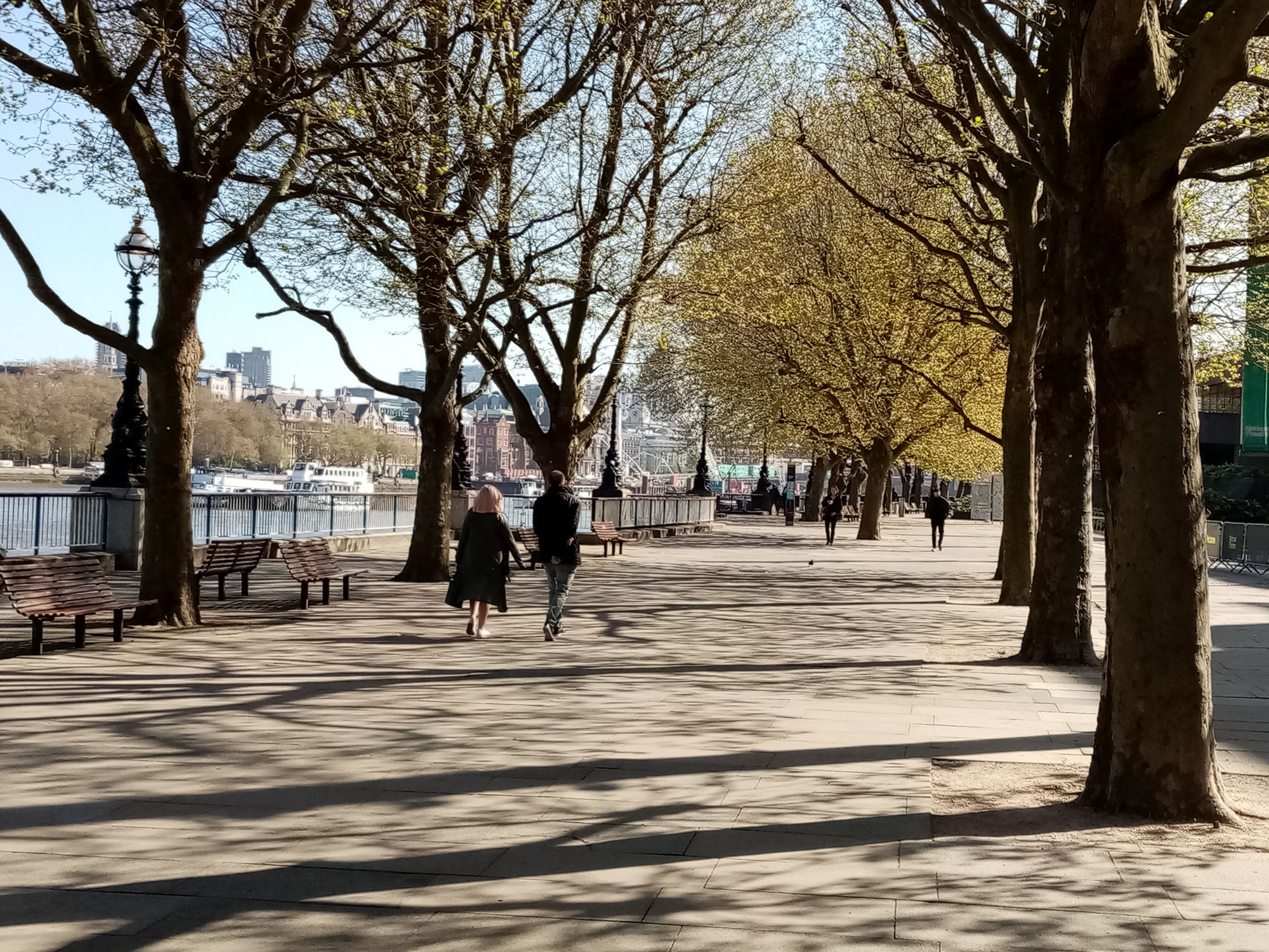
The Queen's Walk forms a long pedestrian boulevard, lined in part by mature London plane trees, and along its route are replicas of George Vulliamy's decorative cast iron lamp standards of 1870, made for the Embankment. The LCC had a number cast in 1933 when County Hall was extended, and in 1964 a further 28 were cast and placed between County Hall and the South Bank. In the 1960s trees were planted on The Queen's Walk as memorials to war dead.
The promenade south of Westminster Bridge is separately designated as Albert Embankment and has good views of the Houses of Parliament. North of Westminster Bridge The Queen's Walk continues past the London Eye, erected in 2000, and flanks Jubilee Gardens (q.v.), opening to a broader area with London plane trees. Between Hungerford Bridge and Waterloo Bridge the riverside has been re-modelled as part of improvements to the Royal Festival Hall. A circular stone sculpture by John Maine, 'Arena' (1983-88) was installed in the centre of the walkway near the Royal National Theatre, which was in built 1969-76 and has itself has undergone restoration works in the 1990s when the public square, Theatre Square, was created adjacent to The Queen's Walk. Other sculptures nearby include 'London Pride' by Frank Dobson, a cast made from the original commission for the Festival of Britain, which was installed near the National Theatre in 1987. The Walk leads on past Gabriel's Wharf, with a viewing platform constructed over the river, to Bernie Spain Gardens, landscaped in the 1980s, this phase of The Queen's Walk completed in the late 1980s. The final section between Bernie Spain Gardens and Blackfriars Bridge are within LB Southwark.
The Queen's Walk is on the circular Jubilee Walkway that was opened in 1977 for the Queen's Silver Jubilee and later re-launched in 2002 in celebration of her Golden Jubilee; a commemorative totem is found by Jubilee Gardens and Jubilee plaques are set into the pavement throughout the Walkway.
Sources consulted:
Ian Yarham, Michael Waite, Andrew Simpson, Niall Machin, 'Nature Conservation in Lambeth', Ecology Handbook 26 (London Ecology Unit), 1994; LB Lambeth 'South Bank Conservation Area Statement' 2007; Martin Hammer and Christina Lodder, 'Constructing Modernity - the Art and Career of Naum Gabo' (Yale University Press, 2000).
Further Information (Planning and Conservation)
- Grid ref:
- TQ312805 (530993,180479)
- Size in hectares:
- Site ownership:
- LB Lambeth
- Site management:
- Friends of Jubilee Gardens
- Date(s):
- 1917; 1949-52; 1983
- Designer(s):
- Listed structures:
- LBI: Royal Festival Hall. LBII*: County Hall (Riverside Building); South Bank Lion; Royal National Theatre; Waterloo Bridge; Westminster Bridge. LBII: London Pride sculpture; Riverside Wall and C19th Lampstandards by County Hall
- On National Heritage List for England (NHLE), Parks & Gardens:
No- Registered common or village green on Commons Registration Act 1965:
No- Protected under London Squares Preservation Act 1931:
No
Local Authority Data
The information below is taken from the relevant Local Authority's planning legislation, which was correct at the time of research but may have been amended in the interim. Please check with the Local Authority for latest planning information.
- On Local List:
- No
- In Conservation Area:
- Yes
- Conservation Area name:
- South Bank
- Tree Preservation Order:
- Yes
- Nature Conservation Area:
- Yes - Metropolitan Importance (Thames)
- Green Belt:
- No
- Metropolitan Open Land:
- Yes
- Special Policy Area:
- Yes - Thames Policy Area; Archaeological Priority Area, Lambeth Waterfront
- Other LA designation:
- None
Photos

The Queen's Walk - Photo: Colin Wing
Date taken: 23/04/21 09:43Click a photo to enlarge.
Please note the Inventory and its content are provided for your general information only and are subject to change. It is your responsibility to check the accuracy.